- How GPS Satellites & Triangulation Work
- GPS Receiver vs. GPS Module: What's Inside the Device
- A-GPS, LBS, and Dead Reckoning: When Satellite Signal Is Weak
- How Data Travels: From Vehicle to Dashboard
- What Happens When the Signal Drops?
- A Brief History: GPS Was Built for the Military
- Accuracy: Can GPS Fleet Tracking Be Trusted?
- Frequently Asked Questions
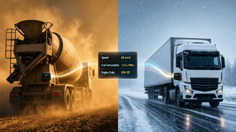
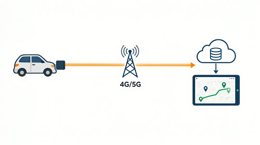
GPS fleet tracking works in four steps: (1) a device in the vehicle receives signals from GPS satellites and calculates its position, (2) the device combines this with vehicle sensor data, (3) it transmits everything over cellular networks to a cloud server, and (4) fleet managers view the processed data on a map dashboard in near real time. The entire cycle typically repeats every 30 seconds to 3 minutes.
How GPS Satellites & Triangulation Work
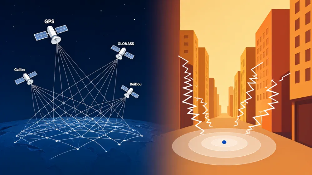
GPS (Global Positioning System) is a constellation of 31 operational satellites operated by the US Space Force, originally developed by the US Department of Defense in the 1970s and opened for civilian use in the 1980s–90s (source: GPS.gov).
Triangulation works like this:
- Each satellite continuously broadcasts its position and the exact time the signal was sent.
- Your tracker’s GPS receiver picks up signals from at least 4 satellites.
- Because signals travel at the speed of light, the receiver calculates distance from each satellite based on signal delay.
- With distances from 4+ satellites, the device solves its exact position — including altitude.
💡 Why 4 satellites, not 3? Three give you latitude, longitude, and altitude; the fourth corrects for clock误差 in the receiver’s cheap internal clock.
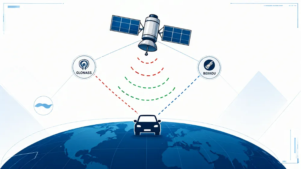
Modern systems also use multi-constellation reception — combining GPS (US), GLONASS (Russia), Galileo (EU), and BeiDou (China) — which improves accuracy and urban performance significantly.
GPS Receiver vs. GPS Module: What’s Inside the Device
People often use “receiver” and “module” interchangeably, but technically:
| Component | Role |
|---|---|
| GPS module (chipset) | The tiny chip (e.g., u-blox, Quectel) that talks to satellites and outputs position data |
| GPS receiver | The module plus antenna — the complete satellite-listening unit |
| Tracker device | Receiver + cellular modem + SIM + processor + backup battery, packaged together |
So when a vendor says their device has a “u-blox module,” they mean the satellite chip inside. When they say “GPS receiver,” they mean the whole antenna+chip assembly.
(📷 Original photo: disassembled tracker showing module, modem, and backup battery — labeled by us)
A-GPS, LBS, and Dead Reckoning: When Satellite Signal Is Weak
Good trackers use fallback positioning methods:
- A-GPS (Assisted GPS): The device downloads satellite orbit data via the cellular network first, cutting time-to-first-fix from ~30 seconds to under 5.
- LBS (Cell Tower Positioning): When satellites aren’t visible (e.g., indoors), the device estimates location from nearby cell towers — accurate only to 100–500 meters.
- Dead Reckoning: Advanced devices use the vehicle’s speed and heading data to “fill in” positions during short signal gaps (tunnels).
How Data Travels: From Vehicle to Dashboard
The full data path:
Vehicle sensors + GPS satellites
        ↓
Tracker device (computes position + reads OBD/CAN bus data)
        ↓
Cellular network (4G/5G) or satellite link
        ↓
Provider's cloud server (stores & processes data)
        ↓
Your dashboard / mobile app / API
Communication Methods Compared
| Method | Coverage | Cost | Used For |
|---|---|---|---|
| 4G/5G Cellular | Excellent in cities | Low (SIM data plan) | Most fleet trackers |
| 2G fallback | Shrinking coverage | Low | Budget/legacy devices |
| Satellite (Iridium/Globalstar) | 100% global, incl. oceans | High | Remote/mining/maritime fleets |
| Bluetooth | Meters only | Free | Driver ID beacons, sensor pairing |
Data Refresh Rates: What “Real-Time” Actually Means
- 30 seconds — premium plans; smooth route playback
- 1 minute — standard for most fleets; plenty for dispatch
- 3–5 minutes — budget plans; fine for theft recovery, weak for live dispatch
- Event-based pings — some devices sleep while parked and wake on ignition or movement (saves battery)
⚠️ Marketing warning: “Real-time tracking” on a plan that pings every 5 minutes is not real-time in any practical sense. Always ask for the update interval in writing.
What Happens When the Signal Drops?
From our testing:
- Tunnels: Trackers lose satellite fix but typically buffer positions and backfill them on reconnection — the route shows a gap or a straight interpolated line depending on the platform.
- Underground parking: GPS fails entirely; LBS or the last known position is shown. Devices with dead reckoning perform best here.
- Remote areas with no cell coverage: The device may record positions locally and upload them when coverage returns (“store-and-forward”). Satellite-tracked devices bypass this problem entirely.
Can GPS trackers work anywhere? Effectively yes for recording (local buffer), but live tracking requires either cellular or satellite connectivity.
A Brief History: GPS Was Built for the Military
- 1970s: US DoD develops NAVSTAR GPS for military navigation; first satellite launched 1978.
- 1983: After Korean Air Lines Flight 007 was shot down, the US opened GPS to civilians.
- 1995: Full operational capability (24 satellites).
- 2000: Selective Availability (military signal degradation for civilians) switched off — accuracy jumped from ~100m to ~10m overnight. This single event made commercial fleet tracking viable.
- ~2000s: First dedicated fleet tracking providers emerge as cellular data networks mature.
- 2010s–now: Telematics, ELD mandates (US, 2017), and dash cams turn GPS trackers into full fleet management platforms.
So, was GPS made for the military? Yes — but the civilian fleet industry was built on top of the declassified version, and today’s multi-constellation GNSS is fundamentally a civilian dual-use infrastructure.
Accuracy: Can GPS Fleet Tracking Be Trusted?
Per GPS.gov:
| Condition | Typical Accuracy |
|---|---|
| Open sky, multi-constellation | 2–5 meters |
| Urban areas (tall buildings) | 10–30 meters (“urban canyon” multipath errors) |
| Under heavy tree cover | 10–50 meters |
| Indoors / underground | No GPS fix (LBS only: 100m+) |
For fleet purposes — dispatch, route verification, geofences — 3–10 meter accuracy is more than sufficient. It is not sufficient for lane-level evidence in accident disputes; that’s what dash cam integration is for.
Frequently Asked Questions
Q: How does GPS fleet tracking work in one sentence?
A device in each vehicle calculates its position from satellite signals and sends it over the cellular network to an online dashboard every 30 seconds to a few minutes.
Q: What is a GPS module?
The small chipset inside a tracker that communicates with satellites and outputs position data; it’s wrapped together with a cellular modem and antenna to make a complete tracking device.
Q: Do GPS trackers work without cell signal?
They can usually record positions locally and upload later, but live tracking requires cellular or satellite connectivity.
Q: How accurate is GPS fleet tracking?
Typically 3–10 meters outdoors; less reliable in tunnels, underground, and dense cities.
Q: When did GPS fleet tracking start?
Civilian GPS accuracy became viable after Selective Availability ended in 2000; commercial fleet tracking grew through the 2000s.
Tags: fleet management software gps, fleet management system gps, gps fleet management software, gps tracking fleet management